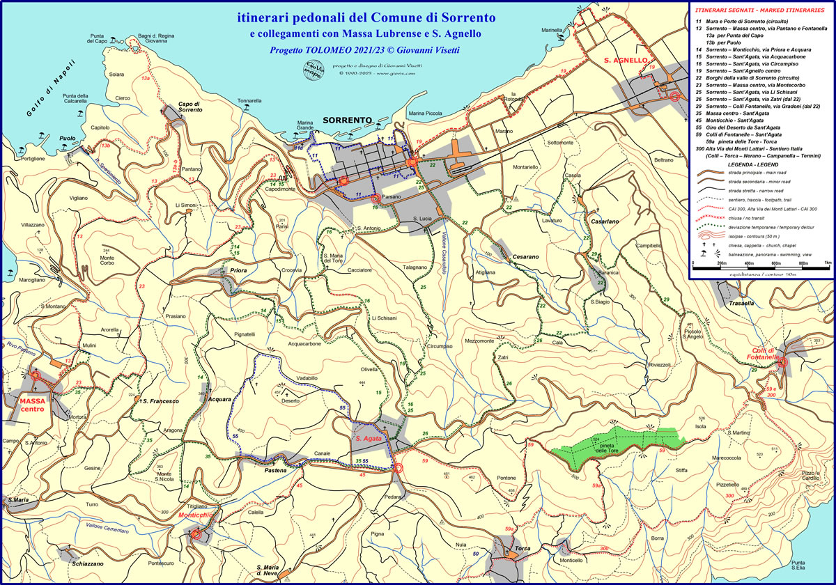
The itineraries of SorrentoWalks are part of the updated version of the Tolomeo Project. As can be seen from the diagram, its “multi-radial” structure (with multiple centres) reaches almost all nearby villages and places of touristic interest. The Sant'Agata hub, terminal of 10 itineraries, is of particular importance thanks to its central position, practically equidistant from Sorrento (route 10), Massa Lubrense (5) and Termini (7), the latter a natural gateway to lesser populated and more open rural areas. Departing from Sorrento (the largest centre of the entire peninsula both for number of inhabitants and number of beds), 9 direct routes to neighbouring areas have been chosen: 2 to Massa centre, 1 to Monticchio, 4 to Sant'Agata, 1 to Colli di Fontanelle centre and 1 to Sant'Agnello. Apart from the latter (reached by a single signposted route), walkers will be able to choose on arrival whether to continue to a different destination following another itinerary. They will also be able to take a break, stock up on food and drink, or even decide whether to continue by public or private transport. As you can see, there is no longer a direct itinerary from Sorrento to the strategic hub of Termini (Massa Lubrense), but this is not a problem because you can get there from any of the other intermediate hubs (Massa centre, Monticchio, Sant'Agata and Colli di Fontanelle). In the diagram, with the central section almost rhomboid in form (the major axis being Sorrento – Termini, the minor Massa - Sant'Agata), you will also find paths leading to the sea, even if most of them are one way, there and back, (Regina Giovanna, Puolo, Marina Lobra, Mitigliano, Campanella, Jeranto and Crapolla). Marina del Cantone and Recommone are the only ones to be found along a route, Alta Via dei Monti Lattari (CAI 300).

Identification and waymarking of the itineraries with codes and colours
The reorganisation of the network includes 23 itineraries and 4 branch routes (increasing to 6 with 59a and 77a still to be opened) and therefore a new criterion of coding was needed for everything to be clear and simple to the walker. To give a logical sense to the numeration, a simple system has been developed so that each hub, (the extremity of an itinerary), has its own number, two in the case of Sant’Agata and Sorrento that are connected by four routes. Each itinerary is identified by a two-digit numerical code (the lowest shown first) which unequivocally links them to the destination. The circuits with coinciding departure and arrival points will consequently have a number with two equal digits. The branch routes keep the code of the main itinerary, followed by a letter (at the bottom, in small letters.) The only exception is the itinerary from Colli di Fontanelle to Termini, which is part of the Alta Via dei Monti Lattari (Sentiero Italia - SI). This keeps Club Alpino Italiano’s code CAI 300 as well as its classical red and white signs. The other CAI paths included on their maps and website www.caimontilattari.it, which coincide totally or in part with the itineraries of the Tolomeo Project, will instead be identified by the Tolomeo codes, with the possibility of indicating both on the signs at their departure points. In this way, walkers will know that they are following the correct CAI route, even if the signs are not the classical red/white ones.

